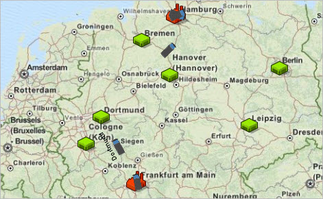
GIS Map shape allows users to import the Geographic Information System into presentations. GIS Map shape displays and manages the world map.
GIS maps are frequently used to define the GIS space in agent based models. GIS space type allows placing agents into geospatial environment defined with a GIS map. GIS space support includes ability to set and retrieve the current location on the map for an agent, to move the agent with the specified speed from one location to another along the existing routes, to execute action upon arrival, to animate the (static or moving) agent at its location, and other useful services.

Implementation is based on OpenMap, which is a geospatial visualization toolkit. One of the main ideas behind OpenMap is that locating your components on the map shouldn't be something you worry about - that's something OpenMap takes care of.
In geospatial terms, a projection is the translation between a spherical model of the earth to a flat, two-dimensional surface. There are different advantages to different projections, depending on the task at hand. In OpenMap, projections are components that handle the translations between latitude and longitude coordinates and screen locations. Cartesian coordinate systems are not easily handled in OpenMap. OpenMap projections only handle translation from decimal degree latitude/longitude data to map view x/y coordinates.
A datum is a definition of how coordinates on the sphere are defined. OpenMap projections assume that latitude and longitude coordinates are defined in terms of the WGS 84 datum. If your data coordinates are defined in a different datum, there will be some error introduced into the map when different data sets are matched.
It's important to make sure your data is compatible with other data being displayed over the same map. OpenMap currently does not have a mechanism for translating coordinates from other datum into WGS 84, but there are packages available on the internet for performing this function.
-
How can we improve this article?
-

